Category:1889 Sanborn Fire Insurance Map from Pasadena, Los Angeles County, California
Jump to navigation
Jump to search
Media in category "1889 Sanborn Fire Insurance Map from Pasadena, Los Angeles County, California"
The following 27 files are in this category, out of 27 total.
-

-
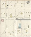
 Sanborn Fire Insurance Map from Pasadena, Los Angeles County, California. LOC sanborn00749 003-1.tif 6,450 × 7,650; 141.17 MB
-

-

-

-

-

-

-
-

-

-

-

-
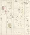
 Sanborn Fire Insurance Map from Pasadena, Los Angeles County, California. LOC sanborn00749 003-2.tif 6,450 × 7,650; 141.17 MB
-

-
 Sanborn Fire Insurance Map from Pasadena, Los Angeles County, California. LOC sanborn00749 003-3.tif 6,450 × 7,650; 141.17 MB
-

-

-
 Sanborn Fire Insurance Map from Pasadena, Los Angeles County, California. LOC sanborn00749 003-5.tif 6,450 × 7,650; 141.17 MB
-

-
 Sanborn Fire Insurance Map from Pasadena, Los Angeles County, California. LOC sanborn00749 003-6.tif 6,450 × 7,650; 141.17 MB
-

-
 Sanborn Fire Insurance Map from Pasadena, Los Angeles County, California. LOC sanborn00749 003-7.tif 6,450 × 7,650; 141.17 MB
-

-
 Sanborn Fire Insurance Map from Pasadena, Los Angeles County, California. LOC sanborn00749 003-8.tif 6,450 × 7,650; 141.17 MB
-

-
 Sanborn Fire Insurance Map from Pasadena, Los Angeles County, California. LOC sanborn00749 003-9.tif 6,450 × 7,650; 141.17 MB


