Category:1880s maps showing history
Jump to navigation
Jump to search
Subcategories
This category has the following 9 subcategories, out of 9 total.
1
A
S
Media in category "1880s maps showing history"
The following 146 files are in this category, out of 146 total.
-
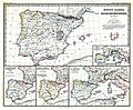 (Spruner-Menke, map 14) The Iberian peninsula 531-711.jpg 3,355 × 2,759; 2.18 MB
-
 (Spruner-Menke, map 15) The Iberian peninsula 711-1028.jpg 3,359 × 2,763; 2.34 MB
-
 (Spruner-Menke, map 16) The Iberian peninsula 1086-1257.jpg 3,338 × 2,767; 2.32 MB
-
 (Spruner-Menke, map 17) The Iberian peninsula 1257-1492.jpg 3,368 × 2,813; 2.68 MB
-
 (Spruner-Menke, map 19) The Iberian peninsula at the start of the 16th century.jpg 3,363 × 2,776; 2.45 MB
-

-
 114 of 'The Youth's History of the United States, etc' (11191099863).jpg 2,029 × 2,387; 1 MB
-
-
-

-
 St. Blasien-Bonndorf - 1789.jpg 591 × 472; 171 KB
-
 CanaanMap-ar.jpg 581 × 950; 530 KB
-
 CanaanMap.jpg 581 × 950; 158 KB
-

-

-
 Elsass im Jahre 1789 - entworfen von Prof.Dr.M.Kirchner in Duisburg... - btv1b102233576.jpg 5,398 × 8,106; 8.74 MB
-
 Elsass im Jahre 1789 - entworfen von Prof.Dr.M.Kirchner in Duisburg... - btv1b531025828.jpg 6,629 × 9,056; 9.98 MB
-
 England i början av 900-talet.jpg 1,089 × 1,292; 458 KB
-
 Turkmenistan BV042517122.jpg 2,054 × 3,410; 765 KB
-
 TIMAYENIS(1881) p1.235 PLATAEA.jpg 1,131 × 1,621; 1.16 MB
-
 TIMAYENIS(1881) p1.422 THE MARCH OF CYRUS.jpg 2,645 × 1,833; 2.79 MB
-
 TIMAYENIS(1881) p2.125 ISSUS.jpg 1,807 × 1,151; 1.41 MB
-
 TIMAYENIS(1881) p2.227 CITY OF RHODES.jpg 1,135 × 1,831; 1.23 MB
-
 TIMAYENIS(1881) p1.208 SALAMIS.jpg 1,867 × 1,183; 1.37 MB
-
 TIMAYENIS(1881) p2.047 MANTINEIA.jpg 1,137 × 1,855; 1.36 MB
-

-

-

-

-
 Ancient peloponnese.jpg 745 × 710; 226 KB
-
 Atlantic Ocean, Toscanelli, 1474.jpg 1,990 × 1,215; 3.01 MB
-

-

-
 Meyers b13 s0173a.jpg 2,048 × 1,718; 713 KB
-
 Meyers b4 s0884a.jpg 2,048 × 1,705; 809 KB
-

-

-
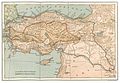
 Asia Minor Map, Classical Atlas, 1886, Keith Johnston.jpg 3,669 × 2,824; 917 KB
-
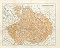
 Deutschland im XIV. Jahrhundert.jpg 5,727 × 4,643; 4.27 MB
-
 Deutschland im XV. Jahrhundert.jpg 5,644 × 4,640; 5.21 MB
-
 Deutschland im XVI. Jahrhundert.jpg 5,772 × 4,605; 5 MB
-
 Droysens-24.jpg 8,925 × 5,837; 4.68 MB
-
 Kulikowo Pole BV044856530.jpg 4,000 × 3,894; 6.19 MB
-
 Lower Nile.jpg 955 × 803; 386 KB
-
 Moskauer Reich BV044856508.jpg 4,000 × 6,209; 3.34 MB
-
 Osteuropa BV044856439.jpg 4,000 × 3,952; 6.71 MB
-
 Preussen-1806.jpg 1,000 × 502; 187 KB
-
 344 of 'The Youth's History of the United States, etc' (11187387234).jpg 2,046 × 2,961; 950 KB
-
 351 of 'The Youth's History of the United States, etc' (11190315526).jpg 2,928 × 1,512; 758 KB
-
 A dictionary of the Bible.. (1887) (14594953738).jpg 1,448 × 1,460; 228 KB
-
 A dictionary of the Bible.. (1887) (14595085170).jpg 3,096 × 1,904; 802 KB
-
 A dictionary of the Bible.. (1887) (14595180150).jpg 2,044 × 3,312; 926 KB
-
 A dictionary of the Bible.. (1887) (14595190740).jpg 2,032 × 3,288; 990 KB
-
 A dictionary of the Bible.. (1887) (14595226549).jpg 2,020 × 3,284; 970 KB
-
 A dictionary of the Bible.. (1887) (14595256698).jpg 2,036 × 3,284; 694 KB
-
 A dictionary of the Bible.. (1887) (14595257738).jpg 3,328 × 2,116; 1,003 KB
-
 A dictionary of the Bible.. (1887) (14595384047).jpg 3,312 × 2,052; 854 KB
-
 A dictionary of the Bible.. (1887) (14595392957).jpg 1,996 × 3,244; 803 KB
-
 A dictionary of the Bible.. (1887) (14779425814).jpg 1,776 × 2,620; 675 KB
-
 A dictionary of the Bible.. (1887) (14779534654).jpg 2,068 × 3,328; 969 KB
-
 A dictionary of the Bible.. (1887) (14781302622).jpg 1,756 × 948; 229 KB
-
 A dictionary of the Bible.. (1887) (14781539332).jpg 2,000 × 3,208; 668 KB
-
 A dictionary of the Bible.. (1887) (14781750285).jpg 1,848 × 1,928; 645 KB
-
 A dictionary of the Bible.. (1887) (14781902895).jpg 3,328 × 2,124; 890 KB
-
 Chittim (1887) (14595257738) (cropped).jpg 733 × 526; 46 KB
-
 Image from page 230 of "A dictionary of the Bible.." (1887) (14595154277).jpg 1,848 × 1,228; 323 KB
-
 A dictionary of the Bible.. (1887) (14758675376).jpg 1,408 × 2,220; 507 KB
-

-

-
 Historische Karte von Jerusalem MK1888.png 739 × 782; 155 KB
-
 Plan von Düsseldorf 1620 Ausschnitt.jpg 958 × 941; 475 KB
-
 Plan von Düsseldorf 1620 gedreht.jpg 1,052 × 1,977; 892 KB
-
 Plan von Düsseldorf 1620.jpg 1,977 × 1,052; 925 KB
-
 The divided kingdom.jpg 1,095 × 1,776; 162 KB
-
 Карта театра войны с персиянами 1827.jpg 8,520 × 6,773; 14.72 MB
-
 FISHER(1888) p48 - Forest of Essex. Disafforestations and Boundaries in 1301.jpg 2,496 × 1,861; 699 KB
-
 149 of 'Historische Wanderung durch die alte Stadt Düsseldorf' (11200013776).jpg 1,517 × 2,413; 776 KB
-
 A General History for Colleges and High Schools - Map 10 Part 1.png 2,072 × 3,140; 5.47 MB
-
 A General History for Colleges and High Schools - Map 10 Part 2.png 1,934 × 3,181; 3.38 MB
-
 A General History for Colleges and High Schools - Map 11 Part 1.png 1,945 × 3,152; 5.63 MB
-
 A General History for Colleges and High Schools - Map 11 Part 2.png 1,977 × 3,208; 5.08 MB
-
 A General History for Colleges and High Schools - Map 12 Part 1.png 1,828 × 2,901; 6.41 MB
-
 A General History for Colleges and High Schools - Map 12 Part 2.png 1,854 × 2,922; 4.4 MB
-
 A General History for Colleges and High Schools - Map 13 Part 1.png 1,795 × 2,906; 6.96 MB
-
 A General History for Colleges and High Schools - Map 13 Part 2.png 1,878 × 2,926; 4.02 MB
-
 A General History for Colleges and High Schools - Map 14.png 2,461 × 1,871; 5.86 MB
-
 A General History for Colleges and High Schools - Map 15.jpg 2,471 × 1,881; 660 KB
-
 A General History for Colleges and High Schools - Map 16.png 2,475 × 1,894; 4.89 MB
-
 A General History for Colleges and High Schools - Map 17.png 2,447 × 1,855; 6.92 MB
-
 A General History for Colleges and High Schools - Map 18.png 2,491 × 1,894; 5.83 MB
-
 A General History for Colleges and High Schools - Map 19.png 2,447 × 1,882; 6.16 MB
-
 A General History for Colleges and High Schools - Map 2.png 1,934 × 3,050; 4.06 MB
-
 A General History for Colleges and High Schools - Map 20 Part 1.png 1,818 × 2,884; 7.58 MB
-
 A General History for Colleges and High Schools - Map 20 part 2.png 1,886 × 2,911; 7.21 MB
-
 A General History for Colleges and High Schools - Map 3 Part 1.png 1,926 × 3,164; 4.69 MB
-
 A General History for Colleges and High Schools - Map 3 Part 2.png 1,949 × 3,181; 5.15 MB
-
 A General History for Colleges and High Schools - Map 4 Part 1.png 1,850 × 3,157; 7.7 MB
-
 A General History for Colleges and High Schools - Map 4 Part 2.png 1,997 × 3,327; 6.42 MB
-
 A General History for Colleges and High Schools - Map 5 Part 1.png 1,918 × 3,153; 5.57 MB
-
 A General History for Colleges and High Schools - Map 5 Part 2.png 1,938 × 3,185; 3.89 MB
-
 A General History for Colleges and High Schools - Map 6 Part 1.png 1,898 × 3,125; 6.48 MB
-
 A General History for Colleges and High Schools - Map 6 Part 2.png 1,949 × 3,161; 3.74 MB
-
 A General History for Colleges and High Schools - Map 7 Part 1.png 3,197 × 1,909; 5.51 MB
-
 A General History for Colleges and High Schools - Map 7 Part 2.png 3,279 × 1,949; 6.72 MB
-
 A General History for Colleges and High Schools - Map 8 Part 1.png 1,926 × 3,129; 6.13 MB
-
 A General History for Colleges and High Schools - Map 8 Part 2.png 1,949 × 3,164; 5.44 MB
-
 A General History for Colleges and High Schools - Map 9 Part 1.png 1,938 × 3,153; 4.87 MB
-
 A General History for Colleges and High Schools - Map 9 Part 2.png 1,977 × 3,196; 4.49 MB
-
 Assyria 1130-606 BC.png 718 × 653; 1,005 KB
-
 Iraq area, 586 B.C..png 741 × 688; 1.09 MB
-
 Mesopotamia & nearby, 7th century B.C..png 472 × 488; 153 KB
-
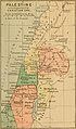
 Palestine (1889 book) 03.jpg 1,808 × 1,740; 396 KB
-
 Palestine (1889 book) 31.jpg 1,701 × 2,897; 531 KB
-
 Toscanelli map.jpg 3,806 × 2,491; 1.72 MB
-

-

-

-
 333 of 'Neue Folge' (11186151104).jpg 1,452 × 1,605; 674 KB
-
 392 of 'La France Illustrée- géographie générale ... Par F. J' (11292231994).jpg 1,177 × 1,167; 375 KB
-
 457 of 'Neue Folge' (11191141843).jpg 2,858 × 4,143; 3.47 MB
-
 A Plan of Rome ancient and modern - by John Henry Parker... - btv1b53021008r (1 of 2).jpg 8,995 × 7,209; 13.62 MB
-
 A Plan of Rome ancient and modern - by John Henry Parker... - btv1b53021008r (2 of 2).jpg 10,799 × 7,144; 15.76 MB
-

-

-

-

-
 Boston 1772.png 1,536 × 1,414; 268 KB
-
 Carré - Le Parlement de Bretagne après la Ligue (Illu. page 589).jpg 2,584 × 1,802; 954 KB
-
 Deutschland im XVIII. Jahrhundert.jpg 5,831 × 4,596; 3.83 MB
-
 Frankrike och england 1180.jpg 952 × 1,785; 695 KB
-
 Grossfuerstentum Moskau.jpg 389 × 564; 79 KB
-

-

-
-
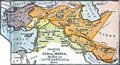 Kingdoms of Lydia, Media, Cilicia, and later Babylonia.png 900 × 486; 889 KB
-
 Maps of the Ancient World.png 1,696 × 1,251; 1.37 MB
-
 Meyers b13 s0363a.jpg 2,048 × 1,754; 773 KB
-
 Meyers b14 s0080a.jpg 800 × 1,020; 313 KB
-
 Meyers b15 s0924a.jpg 800 × 1,070; 309 KB
-
 Palestine (1889 book) 30.jpg 1,647 × 2,813; 546 KB
-
 Palestine (1889 book) 32.jpg 1,623 × 2,778; 522 KB
-

-
 Simond - L'Afghanistan, les Russes aux portes de l'Inde - Carte de l'Afghanistan.jpg 1,892 × 3,000; 5.24 MB
-
 Situationsplan von Karthago.jpg 354 × 404; 50 KB
-
 SouthEast Europe 1878.jpg 1,739 × 1,224; 2.14 MB
-
 Spruner-Menke Handatlas 1880 Karte 47.jpg 3,444 × 2,939; 4.97 MB
_The_Iberian_peninsula_531-711.jpg)
_The_Iberian_peninsula_711-1028.jpg)
_The_Iberian_peninsula_1086-1257.jpg)
_The_Iberian_peninsula_1257-1492.jpg)
_The_Iberian_peninsula_at_the_start_of_the_16th_century.jpg)
.jpg)
.jpg)
.jpg)
.jpg)
.jpg)


_p1.235_PLATAEA.jpg)
_p1.422_THE_MARCH_OF_CYRUS.jpg)
_p2.125_ISSUS.jpg)
_p2.227_CITY_OF_RHODES.jpg)
_p1.208_SALAMIS.jpg)
_p2.047_MANTINEIA.jpg)

%27_(15968009014).jpg)
%27_(16589512952).jpg)
_pour_servir_%C3%A0_l%27histoire_de_la_marine_des_Romains._1884.jpg)


_(14741857236).jpg)
.jpg)


.jpg)
_-_btv1b84394462_(1_of_2).jpg)


.jpg)
.jpg)
_(14594953738).jpg)
_(14595085170).jpg)
_(14595180150).jpg)
_(14595190740).jpg)
_(14595226549).jpg)
_(14595256698).jpg)
_(14595257738).jpg)
_(14595384047).jpg)
_(14595392957).jpg)
_(14779425814).jpg)
_(14779534654).jpg)
_(14781302622).jpg)
_(14781539332).jpg)
_(14781750285).jpg)
_(14781902895).jpg)
_(14595257738)_(cropped).jpg)
_(14595154277).jpg)
_(14758675376).jpg)
.jpg)
.jpg)


_p48_-_Forest_of_Essex._Disafforestations_and_Boundaries_in_1301.jpg)
.jpg)


_03.jpg)
_31.jpg)

.jpg)
.jpg)
.jpg)
.jpg)
.jpg)
.jpg)
.jpg)
.jpg)
_(14741703096).jpg)
_(14761488441).jpg)
_(14762275564).jpg)
_(14784595603).jpg)

.jpg)


%27_(11176072693).jpg)
%27_(11174838534).jpg)
%27_(11180857695).jpg)


_30.jpg)
_32.jpg)
_(14773161645).jpg)


