Category:1880s maps of the Near East
Jump to navigation
Jump to search
Media in category "1880s maps of the Near East"
The following 7 files are in this category, out of 7 total.
-
 Carte Geologique Europe cropped Middle East.JPG 1,022 × 684; 130 KB
-

-
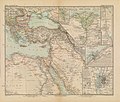 Afrika in 6 Blättern, Sheet 2. - DPLA - 39177aedfe3e739eea71ac7e1c8552db.jpg 1,000 × 846; 263 KB
-
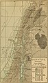 Palestine (1889 book) 28.jpg 1,690 × 2,886; 914 KB
-
 Palestine (1889 book) 29.jpg 1,662 × 2,863; 703 KB
-
 Palestine (1889 book) 33.jpg 1,698 × 2,886; 535 KB
-


%27_(11165427106).jpg)

_28.jpg)
_29.jpg)
_33.jpg)
.jpg)