Category:1880s maps of the Atlantic Ocean
Jump to navigation
Jump to search
Media in category "1880s maps of the Atlantic Ocean"
The following 31 files are in this category, out of 31 total.
-

-
 210 of 'Physiography ... New edition' (11286343634).jpg 1,235 × 891; 234 KB
-
 Admiralty Chart No 1 British Islands to the Mediterranean Sea, Published 1884.jpg 8,151 × 12,101; 26.85 MB
-
 Meyers b2 s0003 b2.png 380 × 460; 87 KB
-
 Meyers b2 s0003 b3.png 380 × 460; 86 KB
-

-

-
-

-

-

-

-
 Admiralty Chart No 1104 Bay of Biscay, Published 1888.jpg 10,383 × 8,256; 9.45 MB
-

-

-
-
 491 of 'Illustreret Norges historie. (With plates.)' (11287155886).jpg 1,362 × 958; 288 KB
-
 5 of 'To America and back- a holiday run' (11185371314).jpg 4,801 × 2,101; 1.68 MB
-

-

-

-
 Anales de la Sociedad Española de Historia Natural (1880) (18165919975).jpg 2,980 × 1,654; 966 KB
-
 Atlantic Ocean shewing the communication between Europe, and North America.png 2,863 × 1,506; 4.44 MB
-
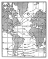
 Atlantikströmungen 1883.jpg 2,916 × 3,893; 4.14 MB
-
 Corrientes del Atántico norte.jpg 2,281 × 1,874; 882 KB
-
 Die Gartenlaube (1885) b 635 1.jpg 824 × 789; 172 KB
-
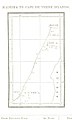
 FMIB 34605 Carte des Profondeurs de l'Atlantique.jpeg 738 × 1,098; 233 KB
-
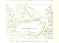
 FMIB 46914 Carte du voyage du Talisman en 1883.jpeg 787 × 656; 117 KB
-
 Meyers b2 s0001a.jpg 1,612 × 2,048; 519 KB
-
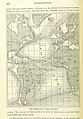
 Pilot chart of the North Atlantic Ocean 11-c.983-1885-s13100k.png 8,730 × 6,921; 173.17 MB
-
 The earth and its inhabitants (1881) (14782070654).jpg 2,912 × 2,330; 1.12 MB

.jpg)


.jpg)
.jpg)
.jpg)
.jpg)
.jpg)
.jpg)
.jpg)

.jpg)
.jpg)
.jpg)
%27_(11287155886).jpg)
.jpg)
.jpg)


_(18165919975).jpg)


_b_635_1.jpg)


_(14782070654).jpg)