Category:1880s maps of Wales
Jump to navigation
Jump to search
Subcategories
This category has only the following subcategory.
1
Media in category "1880s maps of Wales"
The following 16 files are in this category, out of 16 total.
-
 150 of '(A Treatise on Earthy and other Minerals and Mining.)' (11197505164).jpg 1,856 × 1,210; 471 KB
-

-
 Tourist's map of North Wales - btv1b53062126n.jpg 10,662 × 8,284; 14.4 MB
-
 Tourist's map of South Wales - btv1b530619448.jpg 10,419 × 8,296; 14.32 MB
-

-
 150 of 'A Treatise on Earthy and other Minerals and Mining' (11172279134).jpg 1,856 × 1,205; 495 KB
-
 EW(1884) p.210 - Sketch Map of South Wales (left) - A + C Black (pub).jpg 1,285 × 1,899; 381 KB
-
 EW(1884) p.211 - Sketch Map of South Wales (right) - A + C Black (pub).jpg 1,225 × 1,902; 503 KB
-
 EW(1884) p.232 - Sketch Map of North Wales (left) - A + C Black (pub).jpg 1,225 × 1,902; 368 KB
-
 EW(1884) p.233 - Sketch Map of North Wales (right) - A + C Black (pub).jpg 1,225 × 1,902; 526 KB
-
-

-
 Abercwmeiddaw 1887.jpg 531 × 674; 1.43 MB
-
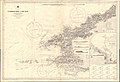 Admiralty Chart No 1410 St Gowan's Head to New Quay, Published 1881.jpg 16,195 × 11,098; 12.75 MB
-
 Map of Chwarel Ddu in 1888.png 1,502 × 1,112; 2.92 MB
-
 Map of Cwm Ebol quarry, 1887.png 1,608 × 936; 2.26 MB
%27_(11197505164).jpg)
.jpg)


_(1883)_(14781884621).jpg)
.jpg)
_p.210_-_Sketch_Map_of_South_Wales_(left)_-_A_%2B_C_Black_(pub).jpg)
_p.211_-_Sketch_Map_of_South_Wales_(right)_-_A_%2B_C_Black_(pub).jpg)
_p.232_-_Sketch_Map_of_North_Wales_(left)_-_A_%2B_C_Black_(pub).jpg)
_p.233_-_Sketch_Map_of_North_Wales_(right)_-_A_%2B_C_Black_(pub).jpg)


%27_(11287208414).jpg)
%27_(11179103965).jpg)