Category:1880 maps of Boston
Jump to navigation
Jump to search
Subcategories
This category has only the following subcategory.
1
Media in category "1880 maps of Boston"
The following 21 files are in this category, out of 21 total.
-
 1880 Boston horse railroads map.jpg 1,588 × 1,575; 661 KB
-

-
 1880 Boston railroads map.jpg 1,546 × 1,554; 654 KB
-

-
 1880 Olmsted proposal for the Emerald Necklace.jpg 8,498 × 2,683; 1.56 MB
-

-
 Boston 1630 1675.jpg 1,566 × 1,450; 648 KB
-
 Boston 1814.jpg 1,580 × 1,444; 573 KB
-
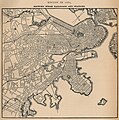
 Boston 1880.jpg 7,744 × 5,104; 6.11 MB
-
 Boston annexations 1880.jpg 1,717 × 1,651; 429 KB
-
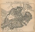
 Boston ground 1880.jpg 1,559 × 1,557; 610 KB
-
 Boston police district 1880.jpg 1,537 × 1,519; 683 KB
-
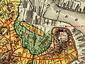 Bulfinch Triangle, Boston, in 1880 on map showing original shoreline.jpg 2,595 × 1,941; 7.59 MB
-
 Plan of Boston Land Cos land in Boston & Revere (2675493554).jpg 1,693 × 2,000; 3.04 MB
-
 Plan of Dorchester (2674667143).jpg 2,000 × 1,551; 2 MB
-

-
 Plan of South Boston (2674677601).jpg 1,892 × 2,000; 3.08 MB
-
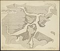 Plan showing encroachments upon the inner basins of Boston Harbor (3120961072).jpg 2,000 × 1,715; 3.31 MB
-

-
 View of Boston, Massachusetts 1880. LOC 75694557.jpg 16,686 × 9,381; 46.78 MB
-
 View of Boston, Massachusetts 1880. LOC 75694557.tif 16,686 × 9,381; 447.84 MB


_(14778575381).jpg)


.jpg)
.jpg)
.jpg)
.jpg)
.jpg)

.jpg)