Category:1876 maps of Missouri
Jump to navigation
Jump to search
States of the United States: California · Illinois · Kentucky · Louisiana · Michigan · Missouri · New Jersey · New York · Ohio · Oklahoma · Oregon · Pennsylvania · South Carolina · Texas · Utah
| ← 1876 → |
Subcategories
This category has only the following subcategory.
Media in category "1876 maps of Missouri"
The following 6 files are in this category, out of 6 total.
-

-

-
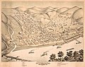 Birds eye view of the city of Louisiana, Pike County, Mo. LOC 2015594060.jpg 7,956 × 6,319; 9.65 MB
-
 Map of the battlefield near Belmont, Missouri LOC 99447442.jpg 6,617 × 5,514; 4.85 MB
-
 Map of the battlefield near Belmont, Missouri LOC 99447442.tif 6,617 × 5,514; 104.39 MB
-
 Pictorial St. Louis Pl. 97.tiff 5,856 × 4,032; 67.56 MB


