Category:1870s maps of the Solomon Islands
Jump to navigation
Jump to search
Countries of Oceania: Australia · New Zealand · Solomon Islands
Other areas: Hawaii – Partly: Indonesia
Other areas: Hawaii – Partly: Indonesia
Media in category "1870s maps of the Solomon Islands"
The following 8 files are in this category, out of 8 total.
-

-

-
 Admiralty Chart No 17 South West Pacific Santa Cruz Is., Published 1870.jpg 5,936 × 7,959; 11.83 MB
-
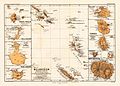 Melanesien (östliche Hälfte) 1870 Karte.jpg 2,372 × 1,700; 1.73 MB
-
 Admiralty Chart No 214 Solomon Islands, Published 1874, Corrections to 1939.jpg 7,480 × 5,088; 4.31 MB
-
 Admiralty Chart No 214 South Pacific. Solomon Islands, Published 1874.jpg 11,641 × 7,952; 20.57 MB
-

-
 Tapoua Utupua 1876 map.jpg 1,343 × 1,266; 173 KB
.jpg)
.jpg)

_1870_Karte.jpg)


.jpg)
