Category:1869 maps of Ontario
Jump to navigation
Jump to search
Media in category "1869 maps of Ontario"
The following 2 files are in this category, out of 2 total.
-
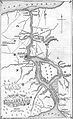 Map of the Niagara Frontier, 1869.jpg 482 × 787; 325 KB
-
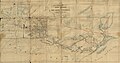 Map Shewing Line of Route Between Lake Superior and Red River Settlement (1869).jpg 15,000 × 7,934; 15.32 MB

.jpg)