Category:1862 maps of Mississippi
Jump to navigation
Jump to search
States of the United States: California · Delaware · Florida · Illinois · Kansas · Kentucky · Louisiana · Maryland · Mississippi · Nevada · New Mexico · New York · North Carolina · Pennsylvania · South Carolina · Tennessee · Utah · Virginia · West Virginia
| 1862 1863 1864 |
Media in category "1862 maps of Mississippi"
The following 9 files are in this category, out of 9 total.
-

-

-
 Civil War newspaper maps from the New York times and the New York herald LOC 2002626099-16.jpg 9,768 × 7,056; 12.22 MB
-
 Defences (sic) of Vicksburg, Decr. 1862 LOC gvhs01.vhs00127.jpg 936 × 1,116; 195 KB
-
 Defences (sic) of Vicksburg, Decr. 1862 LOC gvhs01.vhs00127.tif 936 × 1,116; 2.99 MB
-
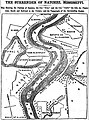 Map of Natchez, Mississippi, United States in May 1862.jpg 2,961 × 4,002; 2.32 MB
-

-
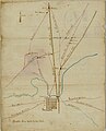 Naid 2070653020 Sketch of the Vicinity of Grenada, Mississippi 01.jpg 2,363 × 2,932; 1.46 MB
-
 Naid 2070653020 Sketch of the Vicinity of Grenada, Mississippi 02.jpg 3,059 × 4,578; 990 KB
_LOC_2006635116.jpg)

_of_Vicksburg,_Decr._1862_LOC_gvhs01.vhs00127.jpg)

.jpg)

