Category:1860s maps showing history
Jump to navigation
Jump to search
Subcategories
This category has the following 7 subcategories, out of 7 total.
1
Media in category "1860s maps showing history"
The following 55 files are in this category, out of 55 total.
-

-

-
-

-

-

-
 1775 - Batalia de la Quebec - dispunerea forţelor.PNG 1,256 × 841; 399 KB
-
 CHODZKO(1861) CARTE DES PAYS SLAVO-POLONAIS AUX VIII ET IX SIECLE.jpg 5,201 × 3,892; 5.45 MB
-
 Crete - ethnic map, 1861.jpg 1,380 × 548; 235 KB
-
 Hispania Karte.jpg 4,442 × 3,285; 6.84 MB
-
 CHODZKO(1861) CARTE DES ÉTATS DE LA REPUBLIQUE DE POLOGNE AUX XVI ET XVII SIECLES.jpg 3,167 × 3,953; 3.85 MB
-
 1861 р.. Ходзько Борейко Леонард Стан на 862 р.jpg 1,600 × 1,198; 553 KB
-
 Jerusalem in the time of Christ (FL36567431 3909081).jpg 2,157 × 3,289; 3.26 MB
-
 Kotlin Island 1706.png 4,355 × 2,473; 3.97 MB
-
 Montclair Belagerung Lith 1863 resized.jpg 1,091 × 774; 170 KB
-

-
 Trachonitis zur Römerzeit.jpg 1,181 × 766; 928 KB
-
 1865 Spruner Map FLEVVM.jpg 478 × 465; 282 KB
-
 Dep-fr.jpg 3,500 × 2,625; 4.03 MB
-
 Cherbourg au 16e siecle.jpg 1,475 × 983; 546 KB
-
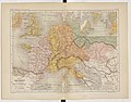
 Roman provinces in a 1867 school atlas.jpg 3,717 × 2,866; 969 KB
-
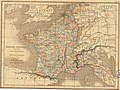
 Atlas général de la France - France 1715 - E. Cortambert.jpg 1,700 × 1,709; 428 KB
-
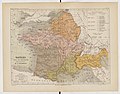
 Atlas général de la France - France 1791 - E. Cortambert.jpg 1,738 × 1,697; 417 KB
-
-

-
-
 Wallhambg.jpeg 1,096 × 725; 714 KB
-

-
 Map of Great Armenia, 1869.jpg 910 × 603; 156 KB
-
 Map of sloboda regiments1764.jpg 858 × 633; 68 KB
-

-
-

-

-
-
-

-
 367 of 'Geschichte der Stadt Hamburg' (11083912344).jpg 2,498 × 2,373; 1.61 MB
-
-

-

-

-

-
-

-

-

-

-

-
 8 of 'The History of Vermont, from its discovery to ... 1791' (11085294165).jpg 2,743 × 3,972; 1.96 MB
-
 Johann Nepomuk Sepp, Palæstina zur Zeit Christi (FL33144862 3882654).jpg 7,520 × 11,148; 120.04 MB
-
 Karte des Thales von Mexico.jpeg 1,421 × 1,242; 538 KB
-

-
 Map of the Serb population, 1862, H. Thiers.png 1,500 × 1,313; 5.31 MB
-
_..._Med_253_Illustrationer_i_Tr%C3%A6snit%27_(11082950496).jpg)
_..._Med_253_Illustrationer_i_Tr%C3%A6snit%27_(11242812056).jpg)
_..._Med_253_Illustrationer_i_Tr%C3%A6snit%27_(11242360673).jpg)
.jpg)
_..._Med_253_Illustrationer_i_Tr%C3%A6snit%27_(11076480933).jpg)
_..._Med_253_Illustrationer_i_Tr%C3%A6snit%27_(11243067564).jpg)

_CARTE_DES_PAYS_SLAVO-POLONAIS_AUX_VIII_ET_IX_SIECLE.jpg)

_CARTE_DES_%C3%89TATS_DE_LA_REPUBLIQUE_DE_POLOGNE_AUX_XVI_ET_XVII_SIECLES.jpg)

.jpg)


%27_(11069428734).jpg)


.jpg)
.jpg)
.jpg)

_..._Med_253_Illustrationer_i_Tr%C3%A6snit%27_(11075455993).jpg)


.jpg)
_..._Med_253_Illustrationer_i_Tr%C3%A6snit%27_(11076210486).jpg)
.jpg)
.jpg)
_..._Med_253_Illustrationer_i_Tr%C3%A6snit%27_(11083083235).jpg)
.jpg)
.jpg)
.jpg)
_..._Med_253_Illustrationer_i_Tr%C3%A6snit%27_(11083060096).jpg)
_..._Med_253_Illustrationer_i_Tr%C3%A6snit%27_(11075563205).jpg)
_..._Med_253_Illustrationer_i_Tr%C3%A6snit%27_(11242982284).jpg)
_..._Med_253_Illustrationer_i_Tr%C3%A6snit%27_(11242328696).jpg)
_..._Med_253_Illustrationer_i_Tr%C3%A6snit%27_(11075705235).jpg)
_..._Med_253_Illustrationer_i_Tr%C3%A6snit%27_(11243153715).jpg)
_..._Med_253_Illustrationer_i_Tr%C3%A6snit%27_(11075730683).jpg)
_..._Med_253_Illustrationer_i_Tr%C3%A6snit%27_(11083853694).jpg)
.jpg)
_..._Med_253_Illustrationer_i_Tr%C3%A6snit%27_(11242757016).jpg)
.jpg)
.jpg)
.jpg)


_(14758304586).jpg)