Category:1860s maps of the Near East
Jump to navigation
Jump to search
Subcategories
This category has only the following subcategory.
1
Media in category "1860s maps of the Near East"
The following 7 files are in this category, out of 7 total.
-

-
 Johnston, Alexander Keith (1804-1871). Turkey in Asia, Transcaucasia. 1861 (G).jpg 2,586 × 1,751; 1.2 MB
-
 Garnier, F. A., Turquie, Syrie, Liban, Caucase. 1862. (A).jpg 2,993 × 2,114; 1.85 MB
-
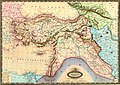
 Garnier, F. A., Turquie, Syrie, Liban, Caucase. 1862. (D).jpg 347 × 338; 46 KB
-
 Garnier, F. A., Turquie, Syrie, Liban, Caucase. 1862.jpg 3,835 × 3,090; 2.23 MB
-
 Das Mittelländische Meer Und Nord-Afrika.jpg 5,652 × 4,701; 10.51 MB
-
 Asie Occidentale 1862.jpg 3,835 × 3,094; 2.06 MB
.jpg)
.jpg)


._Turkey_in_Asia,_Transcaucasia._1861_(CCB).jpg)
._Turkey_in_Asia,_Transcaucasia._1861_(G).jpg)