Category:1860s maps of Tunisia
Jump to navigation
Jump to search
Media in category "1860s maps of Tunisia"
The following 7 files are in this category, out of 7 total.
-
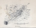 Plan of Utica (1862).jpg 3,156 × 2,424; 4.1 MB
-

-
 Le Tour du monde-11-p015.jpg 1,893 × 2,865; 1.72 MB
-
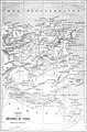
 Das Mittelländische Meer Und Nord-Afrika (Westliches Blatt).jpg 5,771 × 4,795; 11.06 MB
-
 East Numidia (Grayscale).jpg 1,696 × 1,312; 1.02 MB
-
 East Numidia.jpg 1,698 × 1,310; 440 KB
-
 Tunis and Tripoli - DPLA - 9f1040d705f0c6b14940f0aa18e3ea5a.jpg 1,000 × 686; 231 KB
.jpg)


.jpg)
.jpg)

