Category:1860s maps of Serbia
Jump to navigation
Jump to search
Countries of Europe: Albania · Armenia‡ · Austria · Azerbaijan‡ · Belarus · Belgium · Bosnia and Herzegovina · Bulgaria · Croatia · Cyprus‡ · Czech Republic · Denmark · Estonia · Finland · France‡ · Georgia‡ · Germany · Greece · Hungary · Republic of Ireland · Italy · Latvia · Lithuania · Moldova · Montenegro · Netherlands‡ · Norway · Poland · Portugal‡ · Romania · Russia‡ · Serbia · Slovenia · Spain‡ · Sweden · Switzerland · Turkey‡ · Ukraine · United Kingdom
Limited recognition: Abkhazia‡
‡: partly located in Europe
Limited recognition: Abkhazia‡
‡: partly located in Europe
Media in category "1860s maps of Serbia"
The following 5 files are in this category, out of 5 total.
-
 Bulgar-Morava-map.jpg 2,855 × 3,200; 1.6 MB
-
 Donau BV043563753.jpg 3,831 × 9,548; 3.07 MB
-
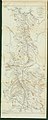
 375 of 'Rys dziejów Serbo-Łużyckich. (With maps.)' (11061913636).jpg 5,046 × 3,918; 3.78 MB
-
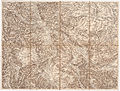
 377 of 'Rys dziejów Serbo-Łużyckich. (With maps.)' (11062823595).jpg 4,872 × 4,148; 4.53 MB
-
 5 - südl Serbien, westl Bulgarien; Scheda-Karte europ Türkei.jpg 5,945 × 4,491; 33.91 MB

%27_(11061913636).jpg)
%27_(11062823595).jpg)
