Category:1860s maps of Liguria
Jump to navigation
Jump to search
- Regions of Italy: Liguria ·
Subcategories
This category has the following 2 subcategories, out of 2 total.
Media in category "1860s maps of Liguria"
The following 6 files are in this category, out of 6 total.
-
 Plan des fortifications projetées au golfe de la Spezia - btv1b53165243t.jpg 5,168 × 3,944; 1.87 MB
-
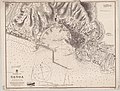 Admiralty Chart No 1461 Genoa, Published 1866.jpg 7,948 × 6,041; 6.6 MB
-

-

-
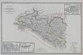
 Vallardi - Albenga e Savona.jpg 4,162 × 6,483; 10.55 MB
-
 Vallardi - Circondari di Chiavari e Levante.jpg 6,361 × 4,267; 10.58 MB


.jpg)
_(14781488104).jpg)

