Category:1860s maps of Bolivia
Jump to navigation
Jump to search
Countries of the Americas: Argentina · The Bahamas · Belize · Bolivia · Brazil · Canada · Chile · Colombia · Costa Rica · Cuba · Ecuador · Guatemala · Jamaica · Mexico · Panama · Paraguay · Peru · Saint Vincent and the Grenadines · United States of America · Uruguay · Venezuela
Other areas: Puerto Rico
Other areas: Puerto Rico
Media in category "1860s maps of Bolivia"
The following 5 files are in this category, out of 5 total.
-
-

-
-
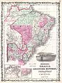
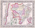
 Map of Brazil, Bolivia, Paraguay, and Uruguay; Map of Chili WDL145.png 1,320 × 1,024; 2.92 MB
-
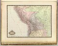 Perou et Bolivie 1862.jpg 3,835 × 3,030; 2.02 MB

;_Harbor_of_Bahia_(inset);_Map_of_Chili;_Island_of_Juan_Fernandez_(inset)_(NYPL_b13663520-1510826).jpg)


