Category:1859 maps of Oregon
Jump to navigation
Jump to search
States of the United States: California · Florida · Massachusetts · Michigan · New York · Oregon · Texas – Washington, D.C.
| 1850 1852 1853 1854 1855 1859 |
Media in category "1859 maps of Oregon"
The following 6 files are in this category, out of 6 total.
-
 A diagram of Oregon LOC 2019586291.tif 7,464 × 5,916; 126.33 MB
-

-

-
 Map of the state of Oregon and Washington territory LOC 2015591073.jpg 11,430 × 8,670; 14.7 MB
-
 Map of the state of Oregon and Washington territory LOC 2015591073.tif 11,430 × 8,670; 283.52 MB
-
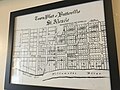 Town plat - Butteville, Oregon.jpg 4,032 × 3,024; 2.03 MB


