Category:1857 maps of Texas
Jump to navigation
Jump to search
States of the United States: California · Florida · Illinois · New Mexico · New York · Ohio · Pennsylvania · Texas · Utah
| ← 1851 1852 1853 1854 1855 1856 1857 1859 |
Media in category "1857 maps of Texas"
The following 9 files are in this category, out of 9 total.
-

-

-
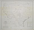
 Map of Texas and Part of New Mexico 1857 (1887) UTA.jpg 4,188 × 2,630; 1.54 MB
-
 Map of Texas and part of New Mexico (NBY 15547).jpg 3,600 × 3,052; 1.28 MB
-
 Map of Texas and part of New Mexico LOC 2015591074.jpg 11,274 × 10,673; 14.84 MB
-
 Map of Texas and part of New Mexico LOC 2015591074.tif 11,274 × 10,673; 344.26 MB
-
 Pressler's map of the state of Texas LOC 2003629174.jpg 16,147 × 14,300; 31.68 MB
-
 Pressler's map of the state of Texas LOC 2003629174.tif 16,147 × 14,300; 660.62 MB
-

.jpg)
_UTA.jpg)
.jpg)


