
Category:1852 maps of the United States
Countries of the Americas: Canada · United States
States of the United States: California · Connecticut · Florida · Louisiana · New York · Oregon · Pennsylvania · Texas · Utah · Wisconsin
Subcategories
This category has the following 12 subcategories, out of 12 total.
.
- 1852 U.S. Coast survey (9 F)
C
- 1852 maps of California (5 F)
- 1852 maps of Connecticut (7 F)
F
- 1852 maps of Florida (6 F)
L
- 1852 maps of Louisiana (1 F)
N
O
- 1852 maps of Oregon (2 F)
P
T
- 1852 maps of Texas (2 F)
U
- 1852 maps of Utah (3 F)
W
- 1852 maps of Wisconsin (1 F)
Media in category "1852 maps of the United States"
The following 21 files are in this category, out of 21 total.
-

-

-
 1852 FaneuilHall Boston map BPL 12850.png 485 × 611; 330 KB
-
 1852 FaneuilHall Boston McIntyre map detail.png 585 × 638; 596 KB
-
 1852 Map of the Virginia Central Railroad and Planned Construction.jpg 8,425 × 5,747; 7.08 MB
-

-
 A Diagram of a Portion of Oregon Territory - NARA - 50926086.jpg 5,280 × 15,004; 12.41 MB
-

-

-

-

-
-
 Map of Marion County, Ohio LOC 2012592377.jpg 10,359 × 6,601; 11.47 MB
-
 Map of Marion County, Ohio LOC 2012592377.tif 10,359 × 6,601; 195.64 MB
-
 Map of Muskingum County 1852.tif 11,389 × 9,780; 318.7 MB
-
 Map of Muskingum County LOC 2012592244.jpg 11,389 × 9,780; 17.56 MB
-
 New map of the state of Missouri. LOC 2012593322 (cropped).jpg 4,890 × 3,970; 4.09 MB
-
 New map of the state of Missouri. LOC 2012593322.jpg 5,964 × 3,970; 4.55 MB
-
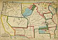
 Phelps's National map of the United States. LOC 98685319.jpg 6,570 × 5,220; 7.95 MB
-
 Phelps's National map of the United States. LOC 98685319.tif 6,570 × 5,220; 98.12 MB
-
 Rev MN Terr 1852 (2).jpg 1,800 × 1,421; 1.19 MB

_-_Geographicus_-_EtatsUnis-duvotenay-1852.jpg)


.jpg)


.jpg)


.jpg)