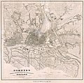
Category:1850 maps of Hamburg
Jump to navigation
Jump to search
Federal states of Germany:
Media in category "1850 maps of Hamburg"
The following 12 files are in this category, out of 12 total.
-
PPN610751190 Hamburg Nebst Dessen Nächster Umgebung Und Altona.jpg 5,695 × 5,641; 7.78 MB
-
PPN610751190 Hamburg Nebst Dessen Nächster Umgebung Und Altona.tif 6,271 × 6,965; 20.13 MB
-
PPN610752545 Hamburgs Umgegend 15 Meilen im Umkreise.jpg 9,655 × 7,727; 15.03 MB
-
PPN610752545 Hamburgs Umgegend 15 Meilen im Umkreise.tif 10,708 × 8,034; 39.96 MB
-
PPN611181169 Hamburg (1850).jpg 3,649 × 2,766; 2.56 MB
-
PPN611181169 Hamburg (1850).tif 3,695 × 3,127; 7.42 MB
-
PPN611215624 Hamburg (1850).jpg 7,634 × 9,349; 12.08 MB
-
PPN611215624 Hamburg (1850).tif 7,899 × 10,755; 35.36 MB
-
PPN611701170 Kleine Ericus-Brücke und Umgebung (1850).jpg 1,551 × 2,992; 2.11 MB
-
PPN611701170 Kleine Ericus-Brücke und Umgebung (1850).tif 2,089 × 3,228; 2.5 MB
-
PPN61172183X Neuanzulegender Begräbnisplatz für St. Jacobi (1850).jpg 5,580 × 7,090; 5.64 MB
-
PPN61172183X Neuanzulegender Begräbnisplatz für St. Jacobi (1850).tif 6,524 × 9,539; 19.59 MB


