Category:1840s maps of London
Jump to navigation
Jump to search
Media in category "1840s maps of London"
The following 28 files are in this category, out of 28 total.
-
 (1840) Distribution of Attorneys in London, Districts of Westminster Hall Courts.jpg 2,844 × 2,094; 2.53 MB
-
 Environs of London Davies map 1841.jpg 700 × 575; 250 KB
-
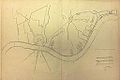
 Primrose Hill 1841.png 1,376 × 869; 2.01 MB
-
 The Kensington Hippodrome, 1841.png 474 × 464; 490 KB
-
 1842 Map of West London.jpg 2,572 × 1,612; 2.41 MB
-
 Thames from Putney to Westminster 1842.jpg 1,404 × 917; 1,004 KB
-
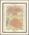
 London and its environs (1844).jpg 369 × 426; 83 KB
-

-
 John Martin - Design for a London sewer, 1845 (BL Maps 3485.(7.)).jpg 4,370 × 2,897; 5.5 MB
-
-
 Proposed Central Railway Terminus.png 781 × 975; 747 KB
-
 Vauxhall 1847 Joseph Cross map detail.jpg 315 × 435; 59 KB
-

-
 1849 London public libraries map HouseOfCommonsSelectCommittee.jpg 620 × 326; 171 KB
-
 Meyer‘s Zeitungsatlas 052 – Gegend von London.jpg 7,150 × 6,070; 15.42 MB
-
 1849 Cruchley Pocket Map of London, England - Geographicus - London-crutchley-1849.jpg 5,000 × 2,607; 4.89 MB
-

-
 Bradshaw's Railway Companion - 1840 - London map.webp 1,972 × 1,325; 2.05 MB
-

-
 Greenwich Heritage Centre, temporary exhibition Plumstead - 4.jpg 3,124 × 2,185; 2.71 MB
-
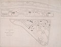 London Zoo anonymous plan 1841.jpg 712 × 543; 80 KB
-
 Longitudinal section - sewer, London, 1844 (BL Maps Crace Port 18.13).tif 4,919 × 2,781; 39.15 MB
-
 Ludwig Ewald, Handatlas der allgemeinen Erdkunde - No. 77. London. Paris, 1846 - David Rumsey.jpg 9,490 × 11,460; 31.07 MB
-
 Report to Her Majesty's principal secretary of state... Wellcome L0067887.jpg 5,300 × 4,210; 6.98 MB
-
 The Environs Of London - Titel.jpg 2,624 × 2,067; 1.72 MB
-
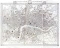
 The Environs Of London.jpg 8,295 × 5,524; 16.12 MB
-
 The Pleasure Bath, Peerless Pool, City Road (BM 1880,1113.5032).jpg 1,908 × 2,500; 714 KB
-
 View of Woolwich, 1841 (R. Rixon).jpg 1,996 × 507; 1.06 MB
_Distribution_of_Attorneys_in_London,_Districts_of_Westminster_Hall_Courts.jpg)


.jpg)

).jpg)


.jpg)


.jpg)
.jpg)