
Category:1840s maps of Brazil
Subcategories
This category has the following 4 subcategories, out of 4 total.
- 1840 maps of Brazil (1 F)
- 1841 maps of Brazil (empty)
.
- 1840s maps of Paraná (1 F)
- 1840s maps of São Paulo (3 F)
Media in category "1840s maps of Brazil"
The following 10 files are in this category, out of 10 total.
-
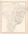
 Detalhe do mapa Brazil (1844), de John Arrowsmith.jpg 2,442 × 2,348; 5.85 MB
-

-
 Brazil. LOC 2003627067.jpg 3,912 × 4,860; 3.52 MB
-
 Brazil. LOC 2003627067.tif 3,912 × 4,860; 54.39 MB
-
 Karte von Brasilien Platt 1848.pdf 2,556 × 3,075; 788 KB
-
 Barclay's Dictionary Brazil.jpg 4,731 × 6,051; 20.01 MB
-

-
 Chart of the coast of Brazil from Maranham to the River Plate RMG F0134.tiff 7,312 × 3,128; 65.44 MB
-

-
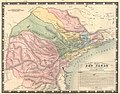 Provincia de São Paulo 1847.jpg 480 × 378; 196 KB
,_de_John_Arrowsmith.jpg)
.jpg)


