Category:1840 U.S. presidential election maps by state
Jump to navigation
Jump to search
English: Results of the 1840 United States presidential election
Media in category "1840 U.S. presidential election maps by state"
The following 16 files are in this category, out of 16 total.
-
 1840 Presidential election in Ohio by congressional district.svg 800 × 866; 428 KB
-
 Alabama Presidential Election Results 1840.svg 810 × 810; 902 KB
-
 Arkansas Presidential Election Results 1840.svg 800 × 699; 576 KB
-
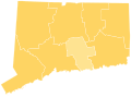 Connecticut Presidential Election Results 1840.svg 810 × 595; 30 KB
-
 Delaware Presidential Election Results 1840.svg 810 × 810; 5 KB
-
 Kentucky Presidential Election Results 1840.svg 744 × 341; 542 KB
-
 Massachusetts Presidential Election Results 1840.svg 810 × 502; 27 KB
-
 Michigan Presidential Election Results 1840.svg 800 × 937; 1.34 MB
-
 Mississippi Presidential Election Results 1840.svg 164 × 284; 1.56 MB
-
 Missouri Presidential Election results 1840.png 3,000 × 2,822; 528 KB
-
 New Hampshire Presidential Election Results 1840.svg 810 × 810; 14 KB
-
 New Jersey Presidential Election Results 1840.svg 810 × 810; 31 KB
-
 North Carolina Presidential Election Results 1840.svg 800 × 306; 1.89 MB
-
 Rhode Island Presidential Election Results 1840.svg 810 × 810; 13 KB
-
 Tennessee Presidential Election Results 1840.svg 3,061 × 779; 632 KB
-
 Vermont Presidential Election Results 1840.svg 810 × 810; 18 KB


