Category:1839 maps of India
Jump to navigation
Jump to search
English: 1839 maps made in India or from India or showing history of India
Media in category "1839 maps of India"
The following 3 files are in this category, out of 3 total.
-
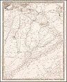
 BEVAN(1839) 1.028 Map of India.jpg 2,504 × 3,192; 3.1 MB
-
 1839 map by the SDUK - The Panjab, with part of Afghanistan, Kashmeer, Sinde, &c.jpg 7,883 × 9,781; 12.77 MB
-
 1839 map of the countries lying between Turkey & Birmah by James Wyld.tif 25,922 × 18,936; 1.37 GB
_1.028_Map_of_India.jpg)
