Category:1832 in England
Jump to navigation
Jump to search
বাংলা: ১৮৩২-এ ইংল্যান্ড
Bosanski: 1832. u Engleskoj
Cymraeg: 1832 yn Lloegr
English: 1832 in England
Dansk: 1832 i England
Deutsch: 1832 in England
Suomi: Vuosi 1832 Englannissa
Svenska: England under 1832
Wikimedia category | |||||
| Upload media | |||||
| Instance of | |||||
|---|---|---|---|---|---|
| Category combines topics | |||||
| Follows | |||||
| Followed by | |||||
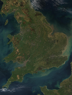
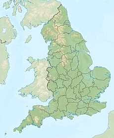
| England | |||||
country in north-west Europe, part of the United Kingdom | |||||
| Spoken text audio | |||||
| Pronunciation audio | |||||
| Instance of | |||||
| Name in native language |
| ||||
| Named after | |||||
| Patron saint | |||||
| Location |
| ||||
| Capital | |||||
| Basic form of government |
| ||||
| Official language | |||||
| Anthem |
| ||||
| Currency | |||||
| Head of state |
| ||||
| Head of government |
| ||||
| Highest point | |||||
| Population |
| ||||
| Area |
| ||||
| Replaces |
| ||||
| Different from | |||||
| official website | |||||
 | |||||
Subcategories
This category has the following 8 subcategories, out of 8 total.
Media in category "1832 in England"
The following 16 files are in this category, out of 16 total.
-
8 King Street Bristol full page.jpg 1,641 × 3,003; 2.73 MB
-
Area of York affected by Cholera epidemic, 1832 Wellcome L0001446.jpg 796 × 2,289; 1.09 MB
-
Brighton - Marlborough Place - View South on Entrance Gate Royal Pavilion 1832 I.jpg 2,592 × 3,915; 9.43 MB
-
C. 1832 England and Wales (Parliament).jpg 2,948 × 3,921; 4.44 MB
-
Gloucestershire 1832 Map.png 1,999 × 2,075; 731 KB
-
Hampshire Administrative Map 1832.png 2,000 × 2,109; 851 KB
-
Hertfordshire Administrative Map 1832.png 2,000 × 1,587; 404 KB
-
Kent Administrative Map 1832.png 2,500 × 1,611; 803 KB
-
Lancashire Administrative Map 1832.png 2,405 × 3,385; 1.34 MB
-
Nottinghamshire Administrative Map 1832.png 1,195 × 2,000; 337 KB
-
Sussex administrative map 1832.png 2,500 × 1,073; 644 KB
-
Lines family sketchbook - Upton Crescett 022.jpg 2,199 × 2,718; 1.11 MB
-
Warwickshire Administrative 1832.png 1,425 × 2,000; 476 KB
-
Yorkshire Administrative Map 1832.png 2,410 × 2,000; 690 KB


