Category:1831 maps
Jump to navigation
Jump to search
| ← · 1830 · 1831 · 1832 · 1833 · 1834 · 1835 · 1836 · 1837 · 1838 · 1839 · → |
Deutsch: Karten mit Bezug zum Jahr 1831
English: Maps related to the year 1831
Español: Mapas relativos al año 1831
Français : Cartes concernant l’an 1831
Русский: Карты 1831 года
Subcategories
This category has the following 8 subcategories, out of 8 total.
Media in category "1831 maps"
The following 64 files are in this category, out of 64 total.
-
 129 of 'Viaggi in Italia. (With plates, including maps.)' (11008224316).jpg 2,604 × 2,380; 1.7 MB
-

-

-

-

-
 A Plan of Swan River Settlement and Surrounding Country.jpg 3,576 × 4,887; 2.61 MB
-

-
 Baradla Cave Vass.jpg 3,000 × 1,429; 1.4 MB
-
 Batailles du Moyen age 6e Feuille. Schlachten des Mittelalters 6tes Blatt (FL37105187 3886546).jpg 14,509 × 11,945; 221.4 MB
-
 Batailles du Moyen age 7e Feuille. Schlachten des Mittelalters 7tes Blatt (FL37105190 3886550).jpg 14,604 × 12,236; 229.42 MB
-
 Bidrag til et geognosisk kart over Jemtland… - no-nb krt 00907.jpg 7,819 × 6,390; 11.13 MB
-

-
 Brromfields 1831 with tramways.jpg 2,619 × 2,162; 3.03 MB
-
 Carte des Isles du Cap Verd, levée en 1819 1820 et 1822 (3120222541).jpg 2,000 × 1,329; 1.95 MB
-

-

-
 Cumae.gif 940 × 594; 85 KB
-

-
 De Heylige en wytvermaerde stad Ierusalem eerst genaemt salem (FL36566186 3902603).jpg 13,321 × 9,944; 208.54 MB
-
 Detailed self-guide to Nagasaki (14616371709).jpg 2,500 × 853; 939 KB
-
 Detailed self-guide to Nagasaki (part 1) (14616464677).jpg 2,500 × 1,475; 1.45 MB
-
 Egipto (FL36566146 3913315).jpg 9,600 × 13,208; 174.75 MB
-
 Eniseysk 1831.jpg 1,112 × 860; 541 KB
-
 Gebirgs-Karte von dem Herzogthum Nassau - urn-nbn-de-0128-1-14729.jpg 6,395 × 7,940; 29.56 MB
-
 Georgia, from the latest authorities. LOC 2010587363.tif 4,536 × 5,105; 66.25 MB
-
 German map showing the path of cholera in Poland, 1831. Wellcome L0076254.jpg 6,385 × 5,848; 12.68 MB
-
 Grundtegning af Kiöbenhavn 1831 - no-nb krt 00767.jpg 9,258 × 6,134; 24.21 MB
-

-
 Ireland 1831.jpg 5,215 × 7,717; 5.13 MB
-

-
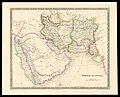 John Dower, Persia and Arabia (FL35061585 2516306).jpg 11,797 × 9,515; 141.46 MB
-

-

-
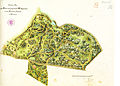 Klein-Glienicke Parkplan Lenné Erweiterung 1831.jpg 4,724 × 3,380; 4.73 MB
-
 LouisendorfGrundriss.jpg 951 × 666; 294 KB
-
 LouisendorfUrkarte.jpg 927 × 1,058; 620 KB
-
 Luristan(Louristan) in 1831.jpg 2,065 × 1,700; 853 KB
-
 Madrid 1831.jpg 6,336 × 4,979; 3.31 MB
-
 Map of Bucks County, Pennsylvania LOC 2007625210.jpg 5,530 × 7,063; 5.62 MB
-
 Map of Bucks County, Pennsylvania LOC 2007625210.tif 5,530 × 7,063; 111.75 MB
-

-

-
 Map of the location of part of the North-Western Turnpike Road LOC 2005625122.jpg 12,511 × 4,613; 6.54 MB
-
 Map of the location of part of the North-Western Turnpike Road LOC 2005625122.tif 12,511 × 4,613; 165.12 MB
-
 Map of the route from London to Paris (FL62896610 2586198).jpg 7,222 × 9,252; 66.08 MB
-

-

-
 Map of the town of Pembroke in the county of Plymouth (3720896564).jpg 744 × 1,024; 668 KB
-
 MukOldMap.jpg 700 × 454; 97 KB
-
 Neueste Specialkarte von Krain nach der dermaligen Eintheilung in Bezirke 1831.jpg 9,294 × 7,224; 13.37 MB
-
 Palaestina (FL45582915 3925749).jpg 2,723 × 3,463; 4.32 MB
-

-
 Plan and profile of the Danville and Pottsville Rail Road. LOC 98688645.jpg 7,808 × 5,840; 5.86 MB
-
 Plan and profile of the Danville and Pottsville Rail Road. LOC 98688645.tif 7,808 × 5,840; 130.46 MB
-
 Plan of London Docks by Henry Palmer 1831.JPG 804 × 634; 213 KB
-
 Plan of the ancient burial place Newton (3720899452).jpg 817 × 1,024; 537 KB
-

-
 Plano de Santiago (1831).jpg 581 × 510; 68 KB
-

-
 Thierry, Asie ancienne (FL33131073 2490326).jpg 10,199 × 6,646; 86.21 MB
-
 Vicente Tofiño de San Miguel, Carte du détroit de Gibraltar (FL13722325 2471361).jpg 14,758 × 10,399; 199.3 MB
-
 World Map by Daniel Lizars (1831?).png 8,600 × 5,823; 95.51 MB
-
 Wuerttembergische Flurkarte 1-2.500 Blatt NO LIV 31.jpg 2,157 × 2,183; 1.6 MB
-
 Wuerttembergische Flurkarte 1-2.500 Blatt NO LIV 32.jpg 2,163 × 2,199; 1.73 MB
%27_(11008224316).jpg)


.jpg)
.jpg)

_(Maps,_with_explanatory_text.)%22.jpg)

.jpg)


.jpg)
.jpg)
_(14616464677).jpg)
.jpg)


.jpg)


.jpg)
.jpg)
.jpg)


_in_1831.jpg)


.jpg)

.jpg)


.jpg)
.jpg)


.jpg)
.jpg)
.jpg)
.jpg)
.jpg)
.png)


.jpg)
_-_btv1b531220481.jpg)