Category:1830s maps of Wales
Jump to navigation
Jump to search
Media in category "1830s maps of Wales"
The following 7 files are in this category, out of 7 total.
-
Verwaltungskarte von England 02.jpg 5,249 × 4,407; 8.35 MB
-
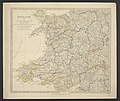
The Useful Knowledge Society's Family Atlas, MAP OF ENGLAND - PART 2.jpg 6,364 × 5,224; 6.8 MB
-
LEWIS(1833) p1.028 MAP OF NORTH AND SOUTH WALES.jpg 1,667 × 1,856; 2.77 MB
-
LEWIS(1833) p2.676 PEMBROKE.jpg 2,889 × 2,357; 3.29 MB
-
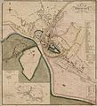
Bangor town plan 4669575.jpg 3,607 × 2,810; 4.55 MB
-
Brecknock town plan 4669580.jpg 2,101 × 2,314; 2.89 MB


