Category:1830s maps of Hawaii
Jump to navigation
Jump to search
States of the United States: Alabama · Alaska · Arizona · Arkansas · California · Connecticut · Delaware · Florida · Georgia · Hawaii · Illinois · Indiana · Iowa · Kansas · Kentucky · Louisiana · Maine · Maryland · Massachusetts · Michigan · Mississippi · Missouri · Nebraska · Nevada · New Hampshire · New Jersey · New York · Ohio · Oklahoma · Pennsylvania · Rhode Island · South Carolina · Tennessee · Texas · Utah · Vermont · Virginia
Puerto Rico
Puerto Rico
Media in category "1830s maps of Hawaii"
The following 9 files are in this category, out of 9 total.
-
 Na mokupuni o Hawaii nei LOC 98680907.jpg 5,790 × 4,163; 3.44 MB
-
 Na mokupuni o Hawaii nei LOC 98680907.tif 5,790 × 4,163; 68.96 MB
-
 A map of the Hawaiian Islands. LOC 2003627048.jpg 6,385 × 5,202; 4.59 MB
-
 A map of the Hawaiian Islands. LOC 2003627048.tif 6,385 × 5,202; 95.03 MB
-
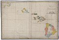 Map of the Hawaiian Islands according to the latest surveys - btv1b53102770q.jpg 13,209 × 8,983; 17.95 MB
-
 Niihau 1838 map by Kalama.jpg 520 × 516; 151 KB
-
 Map of Niihau, Ursula Emerson, 1833.jpg 1,683 × 1,266; 513 KB
-
 Na Mokupuni o Hawaii, 1839, engraved by Kapeau.jpg 2,018 × 1,275; 851 KB
-
 Na Mokupuni o Hawaii, 1839, engraved by Kepohoni.jpg 4,000 × 2,537; 2.84 MB


