Category:1827 maps of France
Jump to navigation
Jump to search
Countries of Europe: Austria · France‡ · Germany · Norway · Russia‡ · Spain‡
‡: partly located in Europe
‡: partly located in Europe
Media in category "1827 maps of France"
The following 8 files are in this category, out of 8 total.
-
 Centre historique de Sainte-Maure-de-Touraine plan cadastral napoléonien.jpg 1,016 × 526; 70 KB
-
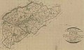
 Lanvénégen plan cadastre.jpg 3,250 × 2,624; 1.55 MB
-

-
 Plan de la ville de Paris, divisé en 12 arrondissemts - Norman B. Leventhal Map Center.tif 7,626 × 5,145; 112.28 MB
-
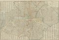
 Plan routier de la ville et fauxbourgs de Paris, 1827 - Stanford Libraries.jpg 13,163 × 9,105; 21.49 MB
-
 Plan routier de la ville et fauxbourgs de Paris, 1827 - Stanford Libraries.tif 13,163 × 9,105; 114.32 MB
-
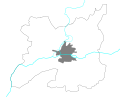 Rennes 1827.svg 477 × 384; 28 KB
-
 Sainte-Maure cadastre napoléonien.jpg 572 × 342; 37 KB


