
Category:1826 maps
| ← · 1820 · 1821 · 1822 · 1823 · 1824 · 1825 · 1826 · 1827 · 1828 · 1829 · → |
Deutsch: Karten mit Bezug zum Jahr 1826
English: Maps related to the year 1826
Español: Mapas relativos al año 1826
Français : Cartes concernant l’an 1826
Русский: Карты 1826 года
Subcategories
This category has the following 8 subcategories, out of 8 total.
Media in category "1826 maps"
The following 35 files are in this category, out of 35 total.
-
 DECKEN(1826) p267 Karten von. Helgoland im Mittelalter.jpg 2,873 × 4,171; 5.09 MB
-
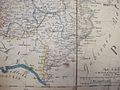
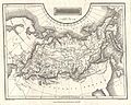 1826 Assheton Map of Russia in Asia - Geographicus - RussiaInAsia-assheton-1826.jpg 3,500 × 2,789; 2.67 MB
-
 2fi4298.jpg 3,888 × 3,166; 469 KB
-
 Admiralty Chart No 1112 Gambier Group, Surveyed by Beechey 1826, Published 1831.jpg 5,967 × 6,113; 3.98 MB
-
-
 Ansicht von Jerusalem und den umliegenden Ortschaften (FL169298899 3487374).jpg 7,117 × 10,059; 82.28 MB
-
 Carl Ferdinand Weiland, Das Osmanische Asien (FL36009901 2715269).jpg 15,222 × 12,311; 278.89 MB
-
 Carte de l'Australie. LOC 00556401.jpg 6,288 × 4,680; 4.59 MB
-
 Carte de l'Australie. LOC 00556401.tif 6,288 × 4,680; 84.19 MB
-
-
 Gambier Islands 1826 map by Beechey.jpg 5,967 × 6,113; 3.98 MB
-

-

-

-

-
 Grundriss der Haupt-Stadt Laibach im Königreiche Illyrien 1826.jpg 7,584 × 6,006; 9.33 MB
-
 Hattin.Jacotin.1826.tiff 832 × 539; 1.28 MB
-
 Impasse du Doyenné.png 1,444 × 996; 1.43 MB
-
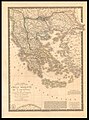
 Jean André Dezauche, Carte De La Grèce (FL35073115 2534582).jpg 19,965 × 15,382; 471.94 MB
-
 Laibach Franziszeischer Kataster.jpg 1,958 × 1,561; 519 KB
-
 Louis Vivien de Saint-Martin, Syriæ mappa generalis (FL13729627 2515299).jpg 6,802 × 9,474; 83.07 MB
-
 M&KR map.gif 2,453 × 2,659; 118 KB
-
 Map of Australia WDL56.png 1,375 × 1,024; 2.57 MB
-
 Map of Guatemala - reduced from the survey in the archives of that country, 1826. LOC 2004629011.tif 7,485 × 5,967; 127.78 MB
-
 Map of Kano-1826.jpg 760 × 492; 65 KB
-
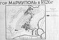 Mariupol map 1826.jpg 1,100 × 765; 185 KB
-

-
 Panorama de la ville de Paris par AM Perrot - Gallica.jpg 6,994 × 4,750; 7.48 MB
-

-
 Powiat tykociński (Województwo augustowskie) 1826 r..JPG 1,280 × 960; 563 KB
-
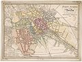 Reymann Neuester Grundriss von Berlin 1826.jpg 8,415 × 6,375; 18.05 MB
-
 Rezé plan cadastral 1826.jpg 936 × 568; 184 KB
-
 Skarth in Skarthstrand.jpg 2,399 × 1,015; 469 KB
-
 Sketch of Bunker Hill Battle (2675105274).jpg 2,000 × 1,327; 2.17 MB
-
 Syria (FL37119316 3897063).jpg 2,874 × 3,267; 2.53 MB
_p267_Karten_von._Helgoland_im_Mittelalter.jpg)


.jpg)
.jpg)
.jpg)

.jpg)


.jpg)

.jpg)


_1826_r..JPG)


.jpg)
.jpg)