Category:1820s maps of the Caucasus
Jump to navigation
Jump to search
Subcategories
This category has the following 4 subcategories, out of 4 total.
A
- 1820s maps of Abkhazia (5 F)
- 1820s maps of Azerbaijan (7 F)
G
Media in category "1820s maps of the Caucasus"
The following 34 files are in this category, out of 34 total.
-

-

-

-

-

-

-

-
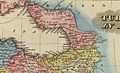 Lucas, Fielding Jr. Turkey in Asia. 1823 B.jpg 1,567 × 958; 392 KB
-
 Lucas, Fielding Jr. Turkey in Asia. 1823 BA.jpg 1,069 × 657; 174 KB
-

-

-
 Louis Vivien de Saint-Martin. Carte General de la Turquie d'Asie. 1824 (A).jpg 3,291 × 5,290; 3.27 MB
-
 Louis Vivien de Saint-Martin. Carte General de la Turquie d'Asie. 1824 (B).jpg 3,009 × 2,168; 1.52 MB
-

-
 Louis Vivien de Saint-Martin. Carte General de la Turquie d'Asie. 1824 (D).jpg 3,114 × 2,169; 1.62 MB
-
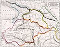
 Kaukasian oblast 1825.jpg 4,858 × 4,746; 5.35 MB
-
 Uebersichts-Karte der Laender zwischen dem Schwarzen und Caspischen Meere.jpg 7,788 × 6,654; 14.73 MB
-

-

-
 Caucasus03333.jpg 778 × 600; 107 KB
-
 Lucas, Fielding Jr. Turkey in Asia. 1823 BB.jpg 661 × 402; 81 KB
-

-

-

-

-

-

-

-
-
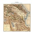 Cənubi Qafqaz 1826-1828-ci illərdi (xəritə).jpg 7,994 × 8,041; 9.09 MB
-
 Das Osmanische Reich in Asien 1829 Georgia.JPG 1,058 × 503; 172 KB
-
 Das Osmanische Reich in Asien 1829 Turkey and Caucasus.JPG 1,959 × 877; 537 KB
-
 Galgaï-Yurt (Галгай-Юрт).jpg 3,104 × 3,928; 4.91 MB
-
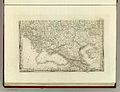
 Карта Южной России, Европейской Турции (1828).jpg 15,200 × 9,963; 29.46 MB
._Arm%C3%A9nie_Russe._Rossijskaja_Armenija._Venice,_(Imprimerie_des_M%C3%A9chitaristes_de)_St._Lazare,_1828.jpg)
.jpg)
.jpg)
.jpg)
.jpg)
.jpg)
.jpg)


.jpg)
.jpg)
.jpg)
.jpg)
.jpg)
.jpg)


.jpg)


.jpg)
.jpg)
.jpg)
.jpg)
.jpg)
.jpg)

.jpg)


.jpg)
.jpg)
.jpg)