Category:1820s maps of North America
Jump to navigation
Jump to search
Temperate regions: North America · South America · Africa · Europe · Asia · Oceania – Polar regions: – Other regions:
Subcategories
This category has the following 16 subcategories, out of 16 total.
Media in category "1820s maps of North America"
The following 3 files are in this category, out of 3 total.
-

-
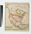 North America. NYPL465038.tiff 4,040 × 4,490; 51.92 MB
-
 Carte physique et politique de l'Amérique septentrionale (NYPL b15063058-434882).jpg 5,786 × 4,192; 4.6 MB
.jpg)