Category:1820s maps of Georgia (U.S. state)
Jump to navigation
Jump to search
States of the United States: Alabama · Alaska · Delaware · Florida · Georgia · Hawaii · Illinois · Indiana · Kentucky · Louisiana · Maine · Maryland · Massachusetts · Michigan · Mississippi · Missouri · New Hampshire · New Jersey · New York · Ohio · Pennsylvania · Rhode Island · South Carolina · South Dakota · Tennessee · Utah · Vermont · Virginia
Media in category "1820s maps of Georgia (U.S. state)"
The following 4 files are in this category, out of 4 total.
-
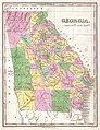 1827 Finley Map of Georgia - Geographicus - Georgia-finley-1827.jpg 2,313 × 3,000; 1.78 MB
-
 Fort Armstrong and Strother.jpg 733 × 593; 71 KB
-
 Mills1825SE 250.gif 247 × 138; 6 KB
-


