Category:1817 maps of Mississippi
Jump to navigation
Jump to search
States of the United States: California · Kentucky · Louisiana · Mississippi · New Mexico · Ohio · Oregon · Pennsylvania · Tennessee · Texas
| 1810 1817 |
Media in category "1817 maps of Mississippi"
The following 2 files are in this category, out of 2 total.
-
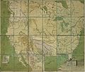
 1817 Map of Mississippi and Alabama.jpeg 4,000 × 3,484; 1.26 MB
-
 Provincias Ynternas Nueva España 1817.jpg 8,866 × 7,520; 8.11 MB

