Category:1812 maps of France
Jump to navigation
Jump to search
Subcategories
This category has the following 2 subcategories, out of 2 total.
Media in category "1812 maps of France"
The following 8 files are in this category, out of 8 total.
-
1812 – Carte des Environs de Paris.jpg 9,512 × 6,632; 11.29 MB
-
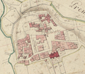
Cadastre napoléonien de Vichy-la-ville, 1812.jpg 2,824 × 1,719; 4.03 MB
-
Calce el 1812.png 388 × 340; 287 KB
-
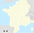
France location map-Departements 1812.svg 2,000 × 1,922; 890 KB
-
Perellós el 1812.png 369 × 409; 303 KB
-
Òpol 1 el 1812.png 540 × 428; 469 KB
-
Òpol 3 el 1812.png 361 × 380; 246 KB


