Category:1810s maps showing history
Jump to navigation
Jump to search
Subcategories
This category has the following 2 subcategories, out of 2 total.
A
- Atlas do dziejów starożytnych (16 F)
Media in category "1810s maps showing history"
The following 23 files are in this category, out of 23 total.
-

-

-
 Plan De Moskow.jpg 4,388 × 3,893; 6.7 MB
-

-
 Territories of the Governorate of Veragua.jpg 720 × 960; 137 KB
-
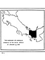 The Dukedom of Veragua.jpg 720 × 960; 117 KB
-

-

-
 Playfair, Principal. Map of the World According to Strabo. 1814 C.jpg 2,743 × 2,391; 1.01 MB
-
 Playfair, Principal. Map of the World According to Strabo. 1814 CB.jpg 960 × 765; 142 KB
-
 Graecia Antiqua Map of Ancient Greece made in 1814.jpg 3,176 × 3,832; 5.44 MB
-
 Canaan Aram. John Melish. The Places Recorded in the Five Books of Moses. 1815.jpg 1,755 × 1,372; 1.67 MB
-
 Central and southern parts of Colchis and part of Iberia.jpg 3,457 × 2,368; 6.43 MB
-
 John Melish. The Places Recorded in the Five Books of Moses. 1815.III.jpg 987 × 1,717; 1.4 MB
-

-
 1810 map of ancient Crete by Christian Gottlieb Reichard.jpg 2,015 × 754; 510 KB
-
 Asia Minor, Syria, Mesopotamia, Armenia, Assyria 01.jpg 9,617 × 5,969; 10.47 MB
-
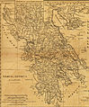
 Graeciae Pars Meridionalis sive Peloponnesus 01.jpg 7,057 × 4,558; 10.28 MB
-

-

-
 John Melish. The Places Recorded in the Five Books of Moses. 1815.II.jpg 5,113 × 4,033; 15.75 MB
-
 Map of Romania by Daniel Philippidis.png 1,162 × 919; 2.28 MB
-
 Playfair, Principal. Map of the World According to Strabo. 1814 CA.jpg 1,302 × 1,103; 251 KB
_(With_plates,_including_a_portrait.)%27_(11001742315).jpg)
_(With_plates,_including_a_portrait.)%27_(11001922473).jpg)

_-_par_J(ean)_D(enis)_Barbi%C3%A9_du_Bocage..._-_btv1b10678664s.jpg)


.jpg)
.jpg)


%27_(11220460695).jpg)
.jpg)


