Category:1810s maps of the Near East
Jump to navigation
Jump to search
Subcategories
This category has the following 2 subcategories, out of 2 total.
Media in category "1810s maps of the Near East"
The following 10 files are in this category, out of 10 total.
-
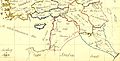
 Bowen, Frances. Turkey in Asia. 1810 (A).jpg 3,844 × 3,433; 1.49 MB
-
 Bowen, Frances. Turkey in Asia. 1810 (G).jpg 3,560 × 1,810; 695 KB
-
 1811 Cary Map of Arabia, Egypt ^ Abyssinia - Geographicus - Arabia-cary-1811.jpg 4,000 × 3,540; 2.84 MB
-
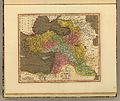
 Darton, William. Turkey in Asia. 1811 (A).jpg 4,560 × 3,818; 3.29 MB
-
 Darton, William. Turkey in Asia. 1811.jpg 6,720 × 5,633; 5.61 MB
-
 Chamouin; Giraldon. Turquie D'Asie. 1812.jpg 650 × 476; 129 KB
-
 Pinkerton, John. Turkey in Asia. 1813 (A).jpg 4,198 × 3,032; 3.28 MB
-
 1817 map of Turkey in Asia by Henry Schenk Tanner.jpg 9,426 × 7,687; 14.36 MB
-
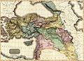
 Asia Minor, Syria, Mesopotamia, Armenia, Assyria 01.jpg 9,617 × 5,969; 10.47 MB
-
 1819 Cary Map of Arabia, Egypt ^ Abyssinia - Arabia.jpg 2,000 × 1,789; 1,008 KB
.jpg)
.jpg)

.jpg)


.jpg)


