Category:1810s maps of Prussia
Jump to navigation
Jump to search
Media in category "1810s maps of Prussia"
The following 14 files are in this category, out of 14 total.
-
A map of Prussia Wellcome V0049919.jpg 3,168 × 2,316; 2.93 MB
-
Russland BV023379535.jpg 9,009 × 6,172; 6.77 MB
-
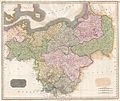
1815 Thomson Map of Prussia, Germany - Geographicus - Prussia-t-15.jpg 5,000 × 4,212; 3.61 MB
-
Carte réduite de la Mer Baltique, IIe Feuille - btv1b105676011.jpg 12,161 × 8,332; 8.6 MB
-
Подробная карта Российской империи и близлежащих заграничных владений — лист 005.jpg 4,887 × 4,478; 9.43 MB
-
Подробная карта Российской империи и близлежащих заграничных владений — лист 006.jpg 4,872 × 4,488; 13.1 MB
-
Подробная карта Российской империи и близлежащих заграничных владений — лист 015.jpg 4,892 × 4,487; 13.53 MB
-
A new and elegent general atlas - Poland.jpg 4,176 × 3,580; 2.2 MB
-
A new and elegent general atlas - Prussia.jpg 4,330 × 3,695; 2.2 MB
-
1818 Pinkerton Map of Poland - Geographicus - Poland-pinkerton-1818.jpg 5,000 × 3,691; 5.15 MB
-
Toeppen Preussen 1818.jpg 4,868 × 3,938; 3.31 MB


