Category:1810s maps of China
Jump to navigation
Jump to search
Media in category "1810s maps of China"
The following 11 files are in this category, out of 11 total.
-

-

-

-
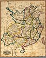 Chinamap1812.jpg 1,188 × 1,495; 424 KB
-
 1815 map of China.jpg 12,496 × 14,332; 30.94 MB
-
 1815 Thomson Map of China and Formosa (Taiwan) - Geographicus - China-t-15.jpg 3,000 × 3,394; 3.11 MB
-
 City of Songjiang in 1818.jpg 3,470 × 2,887; 1.94 MB
-
 大清一統天下全圖.jpg 7,904 × 13,672; 17.54 MB
-

-
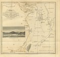 45 of 'Voyage of his Majesty's ship Alceste, to China ... Third edition' (11004359794).jpg 2,883 × 2,752; 1.41 MB
-
 China 1814-1816.jpg 28,165 × 15,994; 75.85 MB
.jpg)


_-_Geographicus_-_China-t-15.jpg)


_-_Geographicus_-_China-pinkerton-1818.jpg)
.jpg)
