Category:1810s maps of Bosnia and Herzegovina
Jump to navigation
Jump to search
Media in category "1810s maps of Bosnia and Herzegovina"
The following 2 files are in this category, out of 2 total.
-
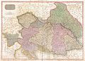 1818 Pinkerton Map of the Austrian Empire - Geographicus - Austria-pinkerton-1818.jpg 5,000 × 3,642; 5.51 MB
-
 Upravni zemljevid Ilirskih provinc leta 1813.jpg 5,742 × 4,752; 22.05 MB

