Category:1805 maps
Jump to navigation
Jump to search
| ← · 1800 · 1801 · 1802 · 1803 · 1804 · 1805 · 1806 · 1807 · 1808 · 1809 · → |
Deutsch: Karten mit Bezug zum Jahr 1805
English: Maps related to the year 1805
Español: Mapas relativos al año 1805
Français : Cartes concernant l’an 1805
Русский: Карты 1805 года
Subcategories
This category has the following 5 subcategories, out of 5 total.
Media in category "1805 maps"
The following 77 files are in this category, out of 77 total.
-

-
 (Map of Spanish West Florida bounded by Rios Comite and Amite). LOC 2012593398.jpg 6,102 × 8,831; 5.56 MB
-
 (Map of the Tunica Bend area, Spanish West Florida). LOC 2013585031.jpg 5,689 × 6,096; 4.34 MB
-

-
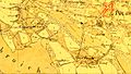
 1805 Westfalen Sektion 19.jpg 1,179 × 832; 580 KB
-
 412 of 'History of Knox County, Ohio ... Illustrated' (11145671996).jpg 1,946 × 2,601; 1.16 MB
-
 A new chart of the Cape Verd Islands, from the latest authorities (8252384935).jpg 1,238 × 2,000; 2.27 MB
-
 Anrath(1805)-(697x396).jpg 697 × 396; 33 KB
-
 AnrathVennheide1805(TrK42-Viersen).jpg 1,328 × 747; 231 KB
-
 Barnet Common on an 1805 map by William Hyett.jpg 735 × 435; 158 KB
-
 BergerstraßeBockert(1805).jpg 1,200 × 675; 1.13 MB
-
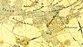
 BettrathNeuwerk1805(TrK42-Viersen).jpg 800 × 450; 560 KB
-
 Borkum 1805.jpg 819 × 514; 308 KB
-

-

-
 Cadastral map of a portion of Feliciana District, Spanish West Florida. LOC 2013585064.jpg 5,938 × 4,010; 2.93 MB
-
 Carte topographique du Tyrol-1.jpg 11,610 × 12,004; 60.67 MB
-
 Carte topographique du Tyrol-2.jpg 11,610 × 12,004; 59.48 MB
-
 Carte topographique du Tyrol-3.jpg 11,610 × 12,005; 58.46 MB
-
 Carte topographique du Tyrol-4.jpg 11,610 × 12,005; 53.89 MB
-
 Christoph Fembo, Aegyptus cum Traglodytice Marmarica et Aethiopia (FL25569745 2370193).jpg 4,362 × 5,098; 32.01 MB
-
 Donk1805(TrK42-Viersen).jpg 800 × 450; 559 KB
-

-
 Florida Occidental, Distrito de Baton Rouge, año de 1805. LOC 2013586080.jpg 6,434 × 9,068; 7.51 MB
-
 Four plats on the Mississippi River at Baton Rouge 1805. LOC 2013585068.jpg 15,423 × 4,870; 8.54 MB
-
 Reilly 765.jpg 338 × 263; 46 KB
-
 Reilly 808.jpg 800 × 1,067; 227 KB
-
 Reilly 809.jpg 295 × 255; 42 KB
-
 France location map-Departements 1805.svg 2,000 × 1,922; 869 KB
-

-

-
 Great Wall of China 1805.jpg 631 × 200; 67 KB
-
 GroßheideVenn1805(TrK42-Viersen).jpg 800 × 450; 537 KB
-
 Harlu map 1805.jpg 586 × 586; 186 KB
-
 Heathers, improved chart of the Bermudas, drawn from the best surveys (8252384803).jpg 1,248 × 2,000; 2.28 MB
-
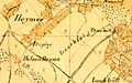 HeimerLockhütte(1805)-(800x500).jpg 800 × 500; 552 KB
-
 HülsdonkRobend(1805)-(800x450).jpg 800 × 450; 533 KB
-

-

-
 Johann Jahn, Jerusalem (FL6878659 2368094).jpg 2,750 × 2,237; 2.4 MB
-
 Johann Jahn, Jerusalem (FL6882150 2368095).jpg 3,350 × 1,845; 2.94 MB
-
 Johnson B. — A Map of the Various Paths of Life — 1805.gif 638 × 919; 406 KB
-
 Jos. Lantz, Plan de la ville de Paris avec ses environs, 1805.jpg 6,628 × 5,173; 10.98 MB
-
 Jos. Lantz, Plan de la ville de Paris avec ses environs, 1805.tiff 7,168 × 5,520; 113.22 MB
-
 Juist 1805.jpg 944 × 548; 362 KB
-
 Langeoog 1805.jpg 798 × 508; 340 KB
-
 Map of France in 1789 by Reilly 700.jpg 353 × 270; 51 KB
-
 Map of France in 1805 by Reilly 701.jpg 338 × 294; 52 KB
-
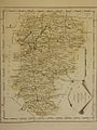
 Map of the district of Chaumont in 1805 by Reilly 715.jpg 575 × 395; 74 KB
-
 Map of the département of Alpes-maritimes in 1805 by Reilly 825.jpg 329 × 276; 50 KB
-
 Norderney 1805.jpg 788 × 526; 298 KB
-
 Phantom islands in Southern Atlantic.jpg 2,716 × 2,011; 933 KB
-
 Plan af Stockholm - no-nb krt 00780.jpg 9,672 × 6,121; 24.15 MB
-

-

-

-

-
 Plan of the battle of Trafalgar RMG K1079.jpg 1,280 × 1,066; 851 KB
-

-
 Plan of township no. 1, north of Phillips LOC 99440240.jpg 6,274 × 5,087; 4.82 MB
-

-

-
 Political Astronomy RMG F8597.tiff 3,570 × 4,800; 49.03 MB
-
 Rasseln1805(TrK42-Viersen).jpg 800 × 450; 62 KB
-
 Reilly 723.jpg 335 × 290; 57 KB
-
 Reilly 753.jpg 500 × 399; 48 KB
-
 Schlacht Caldiero 1805.jpg 1,452 × 760; 331 KB
-
 Schwäbischer Reichskreis 1805.jpg 1,920 × 1,712; 3.87 MB
-
 Spiekeroog 1805.jpg 723 × 554; 298 KB
-

-
 The harbour of St. Augustín in East Florida. LOC 2012590239.jpg 3,710 × 2,315; 1.1 MB
-
 Viersen-Rintgen1805(TrK42-Viersen).jpg 800 × 450; 539 KB
-

-
 Villa nueba de San Carlos, 1805.jpg 3,036 × 4,324; 4.83 MB
-
 William Guthrie, Carta della Terra promessa (FL45612534 3958384).jpg 4,636 × 3,413; 5.95 MB
-
 WinkelnVenn1805(TrK42-Viersen).jpg 1,024 × 576; 851 KB
-
 Карта Саранского уезда 1805 год.jpg 1,009 × 1,063; 382 KB
_LOC_2013585065.jpg)
._LOC_2012593398.jpg)
._LOC_2013585031.jpg)
an_du_si%C3%A8ge_de_Santo_Doming(o)_par_Dess(a)lines,_chef_des_r%C3%A9voltes_de_St._Domingue,_forme_le_15_vent%C3%B4se_et_lev%C3%A9_le_8_germinal_an_13._LOC_00561858.jpg)

.jpg)
.jpg)
-(697x396).jpg)
.jpg)

.jpg)
.jpg)


.jpg)
.jpg)


_Rico_LOC_2004629255.jpg)
_LOC_88693089.jpg)
.jpg)

.jpg)
-(800x500).jpg)
-(800x450).jpg)
.jpg)
.jpg)
.jpg)
.jpg)


.jpg)


.jpg)

.jpg)

.jpg)
.jpg)
