Category:17th-century maps showing history
Jump to navigation
Jump to search
Subcategories
This category has the following 10 subcategories, out of 10 total.
- 1600s maps showing history (18 F)
- 1610s maps showing history (7 F)
- 1640s maps showing history (17 F)
- 1660s maps showing history (12 F)
- 1680s maps showing history (10 F)
- 1690s maps showing history (7 F)
Media in category "17th-century maps showing history"
The following 17 files are in this category, out of 17 total.
-
 Map of Greece by John Speed.jpg 12,637 × 9,961; 27.31 MB
-
 Alexandri magni excursus et expeditio in Asiam - I. Blanchin fc. - btv1b5963613x.jpg 4,816 × 2,984; 2.06 MB
-

-
-

-
 A Map of ancient Africa (FL35469195 2370147).jpg 8,543 × 6,346; 73.37 MB
-

-

-
 Aegypte ancienne - btv1b5964079x (1 of 2).jpg 1,400 × 1,944; 477 KB
-
 Aegyptus antiqua - btv1b53171214z (1 of 2).jpg 6,339 × 4,684; 5.04 MB
-

-

-

-
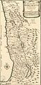
 Carte du voïage des Israëlites. xviie siècle.JPG 2,690 × 2,023; 825 KB
-
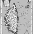 Corse antique.png 768 × 806; 294 KB
-

-
 Orbis vetus juxta Strabonem - (tiré de Cellarius) - btv1b5963496h.jpg 3,568 × 2,568; 1.32 MB


.jpg)
.jpg)
.jpg)
.jpg)
.jpg)


_-_btv1b5963496h.jpg)