Category:17th-century maps of the Isle of Wight
Jump to navigation
Jump to search
Media in category "17th-century maps of the Isle of Wight"
The following 13 files are in this category, out of 13 total.
-
 John Speed - Map of the Isle of Wight - 1610 - 001.jpg 3,500 × 2,622; 3.56 MB
-

-

-
 Vectis Insula Anglice the Isle of Wight - btv1b53056302v (1 of 2).jpg 6,784 × 2,936; 2.52 MB
-
-
 "Vectis Insula Anglice. The Isle of Wight." (22270715771).jpg 3,809 × 2,947; 1.84 MB
-
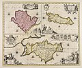
 Vectis Insula by Blaeu.jpg 6,098 × 4,693; 5.47 MB
-
 Vectis Insvla - Atlas Maior, vol 5, map 10 - Joan Blaeu, 1667 - BL 114.h(star).5.(10).jpg 4,000 × 3,375; 1.94 MB
-
 Isle of wight 1685.jpg 674 × 900; 381 KB
-
 UBBasel Map Wight 1685-1686 Kartenslg Mappe 238-31.tif 3,095 × 4,774, 2 pages; 42.3 MB
-
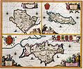
 Mona insula vulgo Anglesey ; Mona insula vulgo The isle of... - CBT 6599408.jpg 5,738 × 4,738; 7.52 MB
-
 Ile de Wight, Chichester - Poole - btv1b530102811.jpg 11,884 × 7,969; 11.02 MB
-
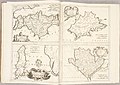 Atlante Veneto Volume 2 014.jpg 10,325 × 7,312; 7.18 MB

.jpg)
.jpg)
.jpg)

.jpg)

.5.(10).jpg)


