Category:17th-century maps of Prussia
Jump to navigation
Jump to search
Media in category "17th-century maps of Prussia"
The following 13 files are in this category, out of 13 total.
-

-
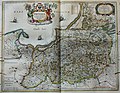 "Prussia accurate descripta - a Gasparo Henneberg Erlichensi." (22064855660).jpg 3,865 × 3,005; 2.46 MB
-

-
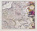
 Atlas Van der Hagen-KW1049B10 037-Tabula PRUSSIAE EXIMIA CURA CONSCRIPTA.jpeg 5,500 × 4,627; 4.39 MB
-
 Atlante Veneto Volume 2 096.jpg 7,130 × 10,568; 7.68 MB
-
 Estats De La Couronne De Pologne.jpg 1,593 × 1,300; 3.07 MB
-
 Poland and Lit.jpg 7,600 × 6,400; 79.72 MB
-

-
 Cartografie in Nederland, kaart van Pruisen, NG-501-44.jpg 5,122 × 4,700; 4.33 MB
-

-

-
 Blaeu 1645 - Prussia.jpg 3,000 × 2,300; 2.23 MB
-
 Merian Schwedische Schantz.jpg 1,200 × 983; 280 KB
.jpg)
.jpg)
.2.(22).jpg)


.jpg)

