Category:17th-century maps of Maine
Jump to navigation
Jump to search
States of the United States: Alaska · California · Connecticut · Delaware · Florida · Georgia · Illinois · Louisiana · Maine · Maryland · Massachusetts · New Hampshire · New Jersey · New Mexico · New York · North Carolina · Oregon · Pennsylvania · Rhode Island · South Carolina · Texas · Virginia
Puerto Rico
Puerto Rico
Media in category "17th-century maps of Maine"
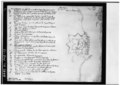
The following 3 files are in this category, out of 3 total.
-
-
 John Smith 1616 New England map.jpg 700 × 609; 205 KB
-
 Pascatway River New England.jpg 3,440 × 2,448; 749 KB

