Category:17th-century maps of Lyon
Jump to navigation
Jump to search
Subcategories
This category has only the following subcategory.
M
Media in category "17th-century maps of Lyon"
The following 9 files are in this category, out of 9 total.
-
 16xx Lion Caloire Guillotiere Vaize Rilliau.png 677 × 543; 676 KB
-
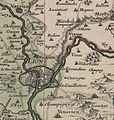 Bresse Bugey Valromay Dombes Viennois 169x (cropped - Zoom on Lyon).jpg 1,318 × 1,391; 651 KB
-
 Cartes de Dauphiné 1613.jpg 8,448 × 5,549; 20.17 MB
-
 Jules Hardouin-Mansart - Projet Bellecour.jpg 676 × 726; 68 KB
-
 La puissante et importante ville de Lyon.jpg 13,044 × 5,094; 33.97 MB
-
 Lugdunum Lyon 16xx.jpg 6,858 × 5,536; 17.27 MB
-
 Lugdunum vulgo Lyon 16xx.jpg 7,931 × 6,128; 20.48 MB
-
 Lyon hopital charite plan.jpg 900 × 622; 257 KB
-
 Ville de Lyon 1656 Zeiller 5032.jpg 3,185 × 2,629; 5.82 MB

.jpg)


