Category:17th-century maps of Haute-Marne
Jump to navigation
Jump to search
Media in category "17th-century maps of Haute-Marne"
The following 5 files are in this category, out of 5 total.
-
 Archidiaconé de Joinville.jpg 6,215 × 4,183; 3.25 MB
-
 Chaumont en Bassigny 16185.jpg 2,579 × 1,771; 4.19 MB
-
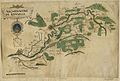
 Eurville.png 367 × 316; 241 KB
-
 Plan de la ville de Langres, avec ses fortifications anciennes et nouvelles.png 1,188 × 1,715; 2.5 MB
-
 Siège de st-Dizier C Chastillon.jpg 3,669 × 2,556; 556 KB


