Category:17th-century maps of Eastern Europe
Jump to navigation
Jump to search
English: This category is for 17th-century overview maps of Eastern Europe that span more than just one or two specific modern countries. For more detailed maps about specific countries or regions, please check the sub-categories.
Subcategories
This category has the following 6 subcategories, out of 6 total.
- 1600s maps of Eastern Europe (14 F)
- 1610s maps of Eastern Europe (3 F)
- 1640s maps of Eastern Europe (3 F)
- 1660s maps of Eastern Europe (2 F)
- 1690s maps of Eastern Europe (10 F)
Media in category "17th-century maps of Eastern Europe"
The following 13 files are in this category, out of 13 total.
-
 Polonia,Lithania,Livonia.jpg 1,600 × 1,176; 527 KB
-
-
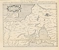
 Map of Eastern Europe (1628).jpg 1,024 × 768; 197 KB
-
-
 Novissima-Rossiae-Tabula-Isaac-Massa-1638.jpg 3,237 × 2,737; 8.32 MB
-
 Новая Россия И Массы.jpg 2,658 × 2,235; 2.08 MB
-
 A-3-37-60-Germany-Sarmathia.jpg 3,000 × 2,260; 1.09 MB
-
 1677 map of the Balkans by Nicolaes Visscher II.jpg 7,239 × 5,950; 11.53 MB
-
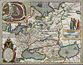
 Visscher Moscoviae seu Russiae magnae generalis tabula large.jpg 5,500 × 4,379; 3.92 MB
-

-
 Polen BV039925754.jpg 10,096 × 8,731; 10.87 MB
-
 Taurica Chersones, nostra aetate Przecopsca et Gazara dicitur - btv1b53040674d (1 of 2).jpg 7,897 × 6,078; 6.46 MB
-


.jpg)
.jpg)


.jpg)
.jpg)
.jpg)