Category:17th-century maps of Boulogne-sur-Mer
Jump to navigation
Jump to search
Media in category "17th-century maps of Boulogne-sur-Mer"
The following 5 files are in this category, out of 5 total.
-
 Boulogne 1634 Tassin 15835.jpg 2,992 × 2,092; 6.67 MB
-
 Boulogne vue 1634 Tassin 15836.jpg 2,981 × 2,074; 6.24 MB
-
 Gouvernement de Boulogne 1634 Tassin 15834.jpg 2,981 × 2,101; 5.84 MB
-
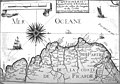 DeSCription des costes de Picardie 16900.jpg 3,938 × 2,750; 4.8 MB
-
 Boulongne - btv1b53144152f (2 of 3).jpg 8,630 × 6,431; 7.11 MB


.jpg)