Category:17th-century maps of Bouches-du-Rhône
Jump to navigation
Jump to search
Subcategories
This category has only the following subcategory.
1
Media in category "17th-century maps of Bouches-du-Rhône"
The following 2 files are in this category, out of 2 total.
-
 Baux de Provence plan.jpg 3,640 × 4,003; 2.73 MB
-
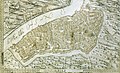 Carte d'Arles.jpg 1,843 × 1,117; 2.62 MB

